Aratta
Searching for Aratta and key sites along the Seven Mountains route
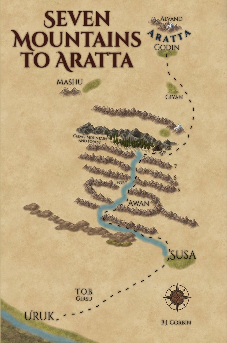
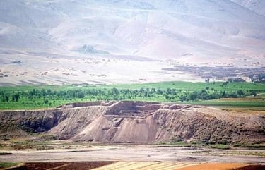
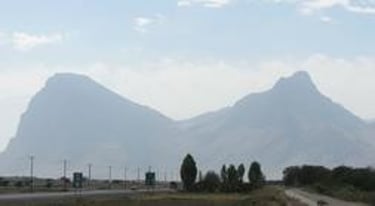
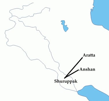
Sumerian texts give specific clues regarding the location of Aratta. From Uruk you pass through Susa and Anshan, then cross the 5-6-7 Mountains in route to Aratta. It must also be close enough to march a 3000-2800 BC army, as described in Enmerkar and the Lord of Aratta. The cover of my book, Seven Mountains to Aratta, shows my proposed route. I consider the archaeological remains of Godin Tepe to be the best candidate for Aratta, and Alvand the most likely mountain for the Ark's landfall. Traces of beer and wine have been found at Godin Tepe, along with molds for metals. Aratta was known as the "mother of goats," and excavations recovered four times as many goat remains as those of any other animal at the site. With hundreds of clay sling balls unearthed, Godin Tepe meets many criteria for being the site of Aratta.
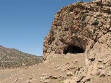
Note that some of the sites on the map are easy to miss, for example, the CAVE is a little difficult to pick out, but this is Yafteh (Japheth?) Cave, that is half the way to Aratta and where I speculate is the cave mentioned in the story of Lugalbanda.
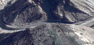
The river from Susa to the Cedar (Hurum) Mountain is the Karkheh (Kar-KAY) River. The Cedar Forest was guarded by Humbaba, before being killed by Gilgamesh and Enkidu. This location is transferred in later accounts from Iran to Lebanon.
I have the Tower of Babel (TOB) placed at the site of Girsu, based on the archaeology and the Book of Jasher 9:23 "... and they went to seek an extensive piece of ground to build the city and tower, and they sought in the whole earth and they found none like the one valley at the east of the land of Shinar, and two days walk, and they journeyed there and they dwelt there." Uruk was the major population center at that time.
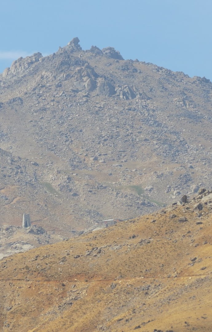
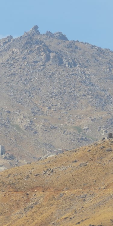
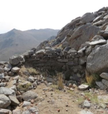
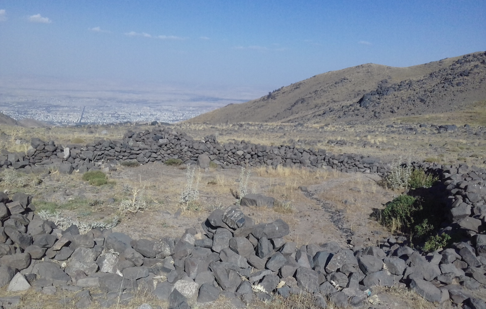
The "fort" just before Mountain Gate 5, is the subject of my book, The Mountainous Gateway to Aratta.

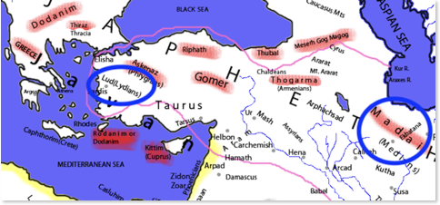
Madai Stayed Behind
A map from "The Historical Textbook and Atlas of Biblical Geography (1854)"
by Lyman Coleman
One of the most intriguing discoveries from my research is the story of Madai, a son of Japheth, who chose not to claim his inherited land in what is now modern western Turkey (Jubilees 10:35). Instead, he preferred to remain with Shem's family and marry Arphaxad's daughter.
In the Book of Jubilees, chapter 10:15, it states, "And Noah slept with his fathers, and was buried on Mount Lubar in the land of Ararat." Earlier, in chapter 7:16, we learn that Shem built his city near Noah on the mountain. Local legend even suggests that Shem is buried near the summit of Alvand Mountain, reinforcing the idea that both Noah and Shem remained close to the site where the Ark landed.
Madai is recognized as the ancestor of the Medes, whose capital, Ecbatana (modern Hamadan, Iran), lies at the northern base of Alvand Mountain. The map above reveals that Lud, a son of Shem, likely exchanged land portions to allow Madai to stay near the Ark's resting place and marry into Shem's lineage.
This narrative is just one of many reasons I believe Alvand Mountain is the most compelling candidate for the Ark's landfall.
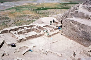
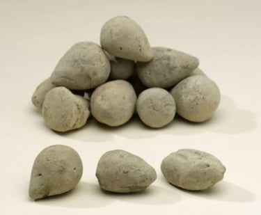
Top (L-R) 1-3 Godin Tepe, 4 Sling stones from Godin Tepe
Credit 1,2,4 to Royal Ontario Museum, with 4 including Virginia R. Badler. 3 M. Mahdi Ahadian
Bottom (L-R) 1 Mystery site, 2 Yafteh Cave, 3 Kuh-e Parau, 4 map showing probable Ark drift direction
Credit 1 B.J. Corbin using Google Earth, 2 S. Shidrang, 3 M. Mahdi Ahadian, 4 B.J. Corbin
Landmarks of Aratta
Most of the Pictures of Alvand Mountain and the Surrounding Sites Are Courtesy of M. Mahdi Ahadian

M. Mahdi Ahadian
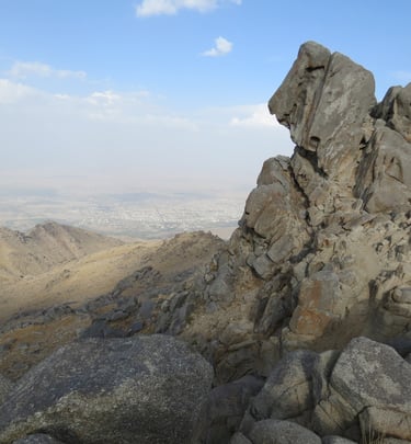
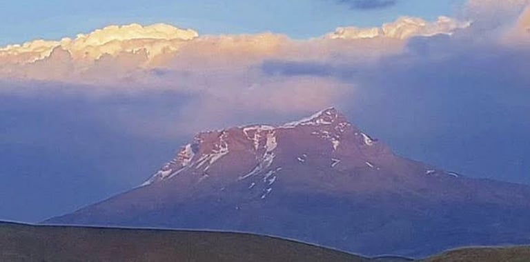
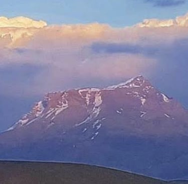
Alvand Mountain
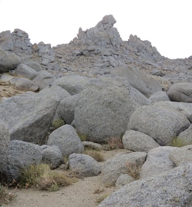
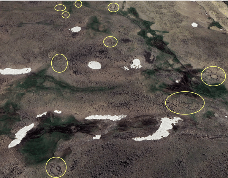
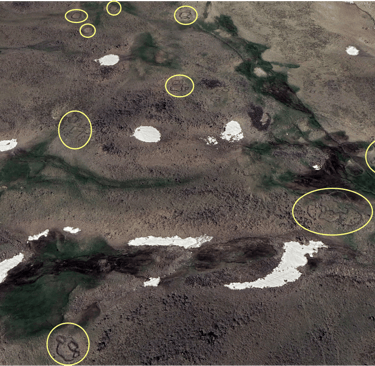
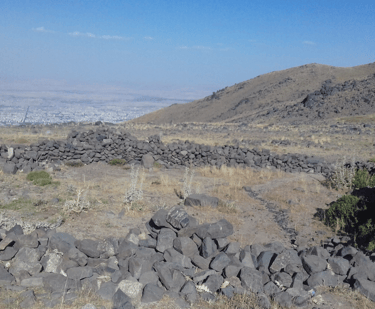
This Google Earth image shows what appear to be stone pens for goats south of Alvand peak.
Khan Gormaz Protected Area photo by Ammar Ebrahimi July 2020
Located about 15 miles southwest of the Alvand peak, with Godin Tepe another 10 miles farther southwest. Wild goats are the primary species in the protected area.

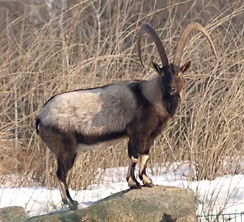
By F. Spangenberg (Der Irbis, own photo) - Uploaded first to de wikipedia on 13:25, 19. Feb 2006 by Der Irbis
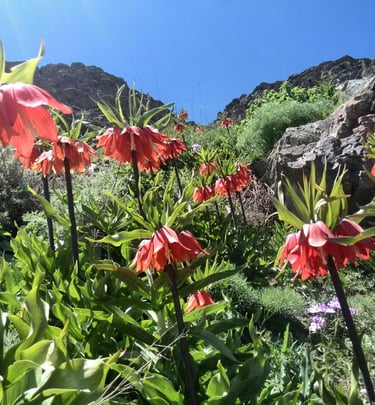
Aratta mother of goats
According to the Sumerian text, Enmerkar and the Lord of Aratta, line 121, aratta ama-ud-da is translated by Jacobsen and Kramer as "Aratta mother of goats."
The archaeological site of Godin Tepe recovered more goat remains than any other animal. We find 5,000 years later, this region is still a popular area for wild goats and sheep.
Close-up of stone circle south of Alvand peak
Photo by M. Mahdi Ahadian
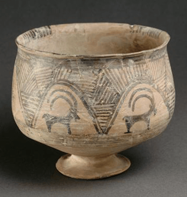
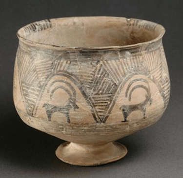
Ibex goat pottery unearthed from Tepe Giyan, approximately 25 miles southeast of Godin Tepe
(This pottery may be located at the Louvre Museum)